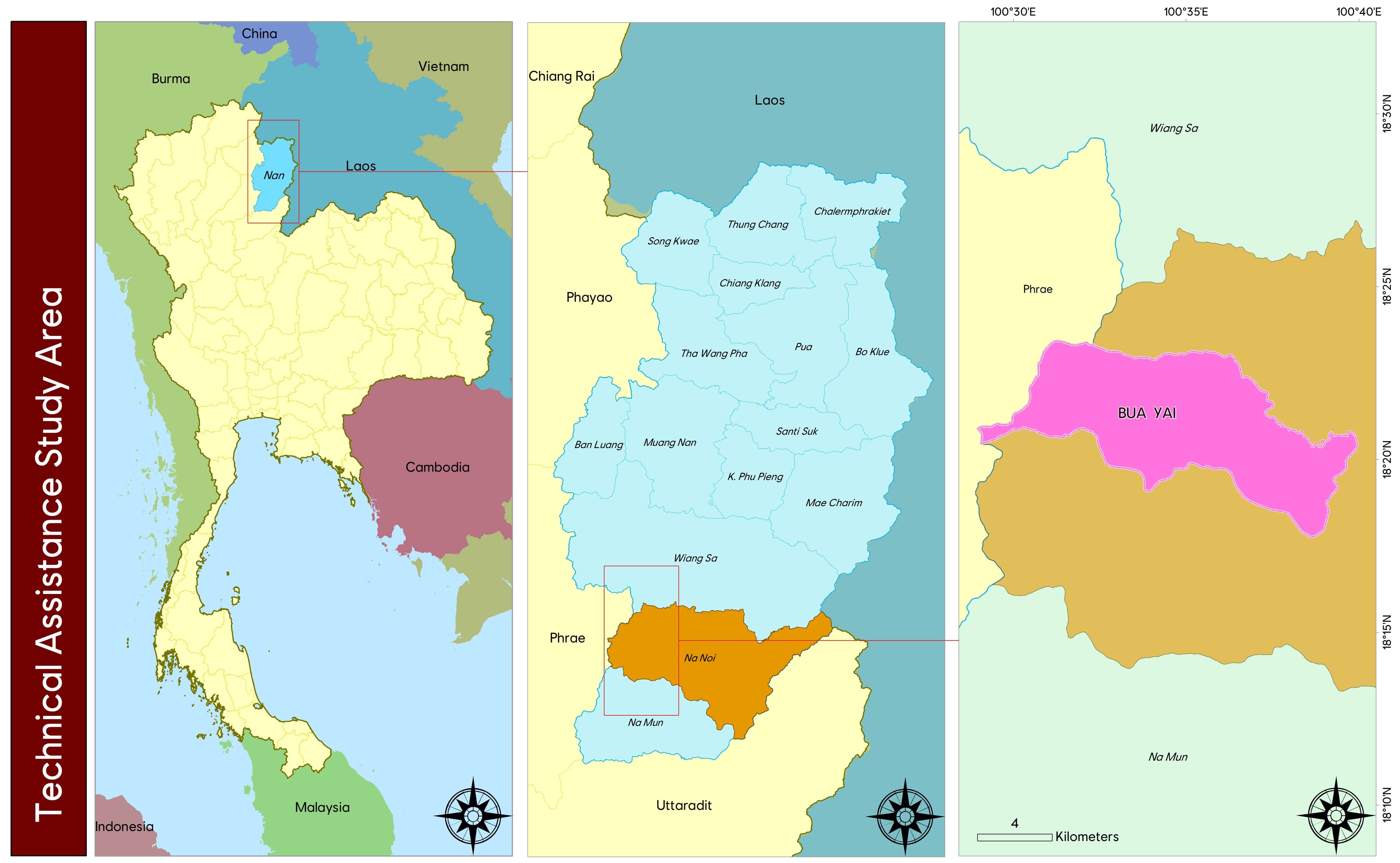
Nan Province is in the eastern part of northern Thailand, with Lao PDR on its eastern border. Neighboring provinces include Phayao, Phrae and Uttaradit. The population is approximately 480,000 (2018). Most of the Nan Province population is Northern Thai (80%) living mostly in the lowlands; the rest comprise five key ethnic minority groups (Lau, Hmong, Mien, Khmu and Mlabri). The biggest group is the Lau (42%), followed by the Hmong (31.9%). In each district, most people live outside the municipal areas (87.7%), and most of the population is of working age (70%). The dependency ratio is 0.43 (Kitchaicharoen et al. 2015)[1].
Approximately 85% of the province’s land area is mountainous. It is the origin of Nan watershed, one of the 25 main watersheds in Thailand. Lowland areas constitute only 2.51% of total land. Agriculture is the main source of income for local people, but areas suitable for agriculture are limited. In addition to its important agricultural and forestry land uses, Nan Province is also important for Thailand’s biodiversity, with the Doi Phu Kha and Khun Nan national parks, homes to wild boars, black bears, reptiles, and birds, as well as many important plant species.

Agriculture plays a key role in the economy and livelihood of most of the population, particularly tribal people. Most of the lowlands are dominated by ethnic Thai, whereas the highlands and mountainous territories are populated by other ethnic groups. Land suitable for cultivation is limited: agricultural land in 1977 covered 5.3% of the province. In 2007 agricultural land increased to 10%, with 42% of this area used for maize cultivation. In the last decade, the province faced a maize boom and rapid expansion of rubber plantations. In 2016 maize cultivation covered approximately 127,000 ha, which was nearly fivefold and two-fold greater area than in 2005 and 2007, while the rubber plantations increased over four-fold during 2005–2016. Agricultural land increased to 27.3% of the province’s area, with 13% of this area irrigated.
Long-term monitoring by the Land Development Department (LDD) and the Royal Forest Department (RFD) showed that forest cover in Nan province declined from 92% in 1977 to 61% in 2016. The greatest deforestation rate of 33% (or 14% per annum) was recorded during 2009–2012. Protected areas (national parks) and class 1 watersheds cover about 35% and 45% of the area. These two land-use types are recognized as conservation forests and agricultural development, extraction of non-timber products and human settlement are prohibited in these areas. Rapid agricultural expansion driven by favorable market price for maize and government incentives for rubber plantations in the last decade has triggered extensive deforestation in conservation forests (Trisurat et al. 2019)[2].
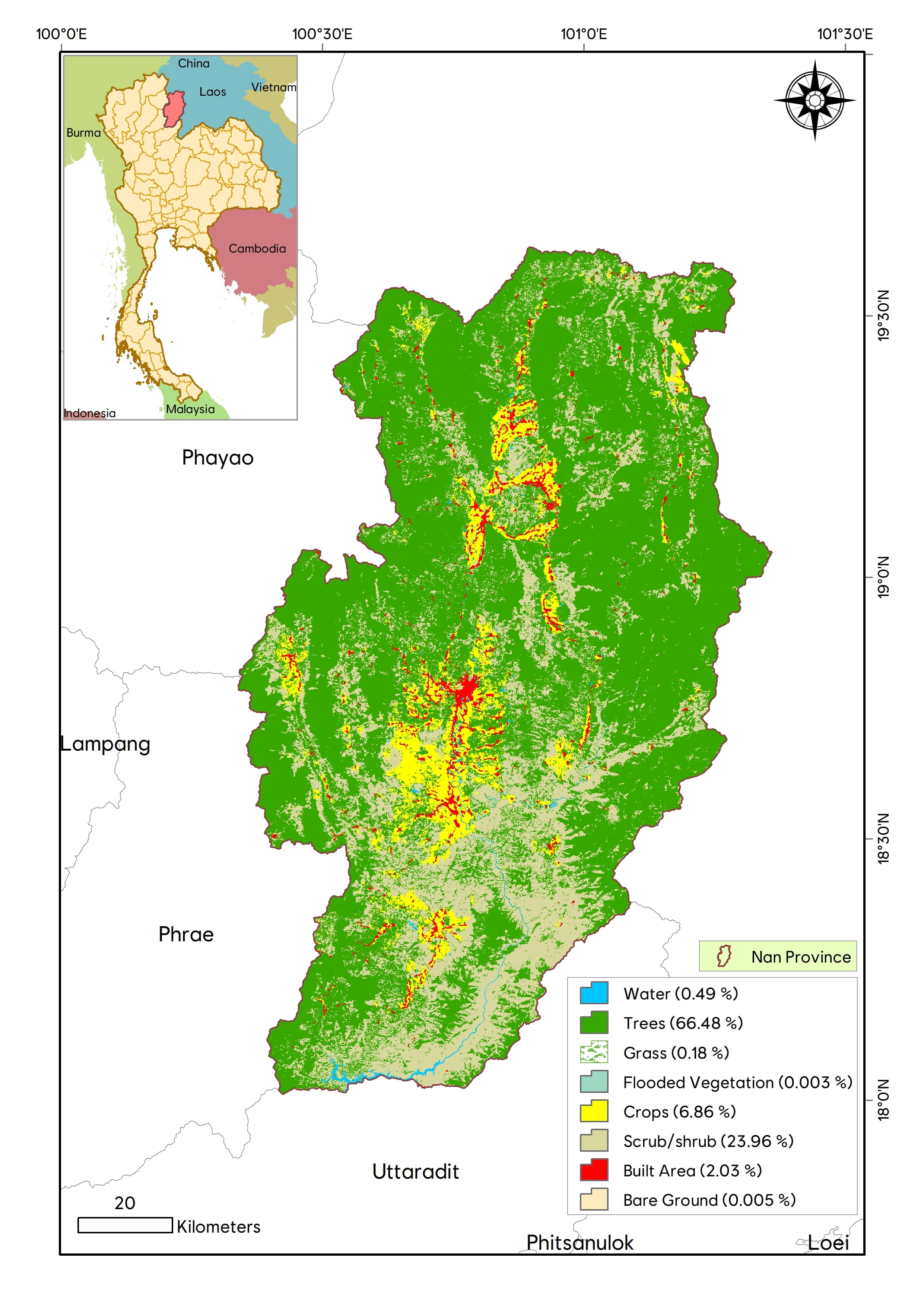
The map on the right shows the land cover of Nan province as of 2020[3].
